Nata (Natá)
Nata (Νατά) is a small village in the Paphos area of southwest Cyprus. It is a small relatively unspoilt traditional village situated on the south-eastern hillside of the Xeros River Valley with approximately 300 residents that is slowly growing due to the number of foreigners wanting to live there. The valley is green in winter but brown in summer.
It has views to the Mediterranean Sea and Troodos Mountains. It is approx 20 minutes from the centre of the town of Paphos and about 10 minutes to the sea. There is an international airport approx 15 minutes from Nata.
The biggest dam in Paphos starts at Nata and supplies water to the majority of Paphos District which has a population of 76,100.
The village has a traditional village restaurant known as Perikli's tavern and about 4 traditional cafes.
It has numerous festivities during the year especially during mid-August for Panagias (Greek: Παναγία) day which are festivities relating to the Virgin Mary. It has a beautiful church called St. Nicholas (Άγιος Νικόλαος, Agios Nikolaos) in the centre of the village and another church under renovation built around the 14th century which is heritage listed.
Many persons left the village in the 1950s and 1960s when conditions were harsh and little opportunity existed. Most moved to Australia mainly to Melbourne and Perth. Some went to Germany, England, South Africa and Canada where they have prospered and educated their children who greatly contributed to the development of their adopted countries.
Map - Nata (Natá)
Map
Country - Cyprus
 |
 |
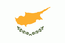
| Flag of Cyprus | |
The earliest known human activity on the island dates to around the 10th millennium BC. Archaeological remains include the well-preserved ruins from the Hellenistic period such as Salamis and Kourion, and Cyprus is home to some of the oldest water wells in the world. Cyprus was settled by Mycenaean Greeks in two waves in the 2nd millennium BC. As a strategic location in the Eastern Mediterranean, it was subsequently occupied by several major powers, including the empires of the Assyrians, Egyptians and Persians, from whom the island was seized in 333 BC by Alexander the Great. Subsequent rule by Ptolemaic Egypt, the Classical and Eastern Roman Empire, Arab caliphates for a short period, the French Lusignan dynasty and the Venetians was followed by over three centuries of Ottoman rule between 1571 and 1878 (de jure until 1914).
Currency / Language
| ISO | Currency | Symbol | Significant figures |
|---|---|---|---|
| EUR | Euro | € | 2 |
| ISO | Language |
|---|---|
| EN | English language |
| EL | Greek language |
| TR | Turkish language |


